Approximate determination of the geodetic coordinates of the point.
Determine the grid, the size of the coordinate cells.
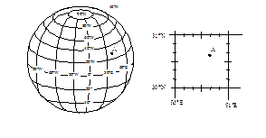
Geographic coordinates of individual points is determined by the border of a map and a grid of meridians and parallels of latitude and longitude values. Depending on the scale of the map set different layout grid of meridians and parallels. As a rule, on the maps scale 1:500000 and 1:1000000 division markings are within five minutes of arc, and on maps and 1:2000000 1:4000000 - ten.
To determine the geographic coordinates on the map to the point it is necessary to push through the segments of straight lines parallel to the closest parallels and meridians, and then at the points of intersection of these lines with lines marking clock at the desired latitude and longitude.
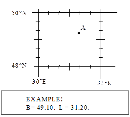 Should expect some rough result, its value must be within the coordinates of the cell. If the result does not fit - to count.
The exact definition of the coordinates of the map? - See the tutorial air navigation
Дата добавления: 2015-06-10; просмотров: 1050;